Getting Here

The John S. Knight Center is centrally located in the heart of downtown Akron, Ohio, within 500 miles of 50% of the U.S. population.

Getting here is easy. The Center is located 11 miles away from Akron/Canton Airport and 30 miles from Cleveland Hopkins International Airport. 

Interstate 77, I-76, and State Route 8 all run through downtown Akron, and are just blocks away from the Center. These major highways connect with other regional routes including I-71, I-271, and the Ohio Turnpike.​

Detour

The highway systems running through Greater Akron are getting some great improvements during the coming months. For a complete list of closures and detours, click here.


Drive Akron


For Akron specific info, click here.

OHGO app

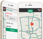
Be the first to know, before you go. With the OHGO app, drivers get real-time traffic updates, personalized route notifications, can view live traffic cameras and get accurate delay times. Click the image to download the app today!

Questions about parking? View parking map and rates here. ​

Approximate mileages to the Center are as follows:

  • Atlanta - 637
  • Chicago - 370
  • Cincinnati - 238
  • Columbus - 127
  • Dayton - 200
  • Indianapolis - 259
  • Montreal - 596
  • Nashville - 478
  • New York City - 438
  • Pittsburgh - 110
  • St. Louis - 494
  • Toledo - 125
  • Toronto - 322
  • Washington, D.C. - 311